
Where: Chiaksan (치악산) is located in Gangwando, the north-eastern most province of South Korea. Easily accessible from the capital region of Seoul, it’s a fairly popular park but perhaps not quite as busy as Seoraksan. Elicia and I were in the midst of a two-park weekend binge, first hitting up Sobaeksan on a Friday and then visiting this national park, Chiaksan, on Saturday. Since they’re only an hour apart, this was quite convenient. Here’s a map showing the location of both, along with a sprinkling of the other nearby national parks.

Hiking Highlights: Waking up in a motel fairly early in the morning in Jecheon city because our camping plans fell apart in Sobaeksan the day before, we hit the road and drove the remainder of the way to Chiaksan. To position ourselves near the highest peak (Birobong, 비로봉) and next to two different campgrounds, we drove around to the northern park entrance and information center called Guryong (구룡). This area also shares the name with the big temple called Guryonsa (구룡사). Sure, there’s other parts of Chiaksan to explore, but I felt like this would be the best area because there’s a temple, waterfalls, and the highest peak all within reach. This recipe has worked well in the past, so we’d stick to the game plan!
Since it was early in the morning and we had the whole day ahead of us, we’d once again try to find a spot for our tent. The first campsite we tried was Guryong Auto Campground, and just like in Sobaeksan, no luck there. We didn’t have reservations, and huge tents left little room, even for our little NorthFace Tadpole tent. The ranger said we couldn’t stay there, but thankfully I saw another campsite using Naver Maps and so we drove into the park in pursuit of a place to plop our tent. It seemed we were driving where we shouldn’t – the guards let us past some gates and whatnot, basically driving on the paved hiking trail. We went to Daegok Campground, which turned out to be more of a student or kid-friendly nature experience area than a campground. We saw a few other families camping there, so we thought, hey, why not? We parked the car and after hiking, would make Daegok our home for Saturday night. Phew! We could camp!

In the above trail map you can see the Guryong entrance and also Daegok Campground where we would start and finish our day’s hike. Unfortunately there isn’t a huge network of trails in this area, but it’s a convenient place to start in Chiaksan to take you up to the 1288m peak called Birobong Peak. Also in light green you can see the route we took from the bottom up to Birobong, and back down the adjacent trail. A simple out-and-back, but there’s two different trails you can take that connect Seryeom Waterfall (세렴폭포) to Birobong Peak. A change of scenery is always welcomed, right?

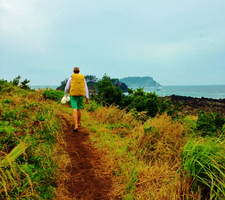
So, the stage is set. We found a nice spot for camping, our backpack was filled with high-calorie foods, and we walked up the very easy trail to Guyonsa Temple. This initial walk is really peaceful, flat, and deep into the woods of tall, mature trees.

The walk went quick, and we found ourselves at Guryonsa Temple. The crowds were thin, but people were beginning to file in to enjoy the day. The temple’s setting was neat because the sun’s rays were beating in and the tall mountains loomed in the background. We were able to fill up our water bottles here at the temple, and then we hit the trail again with Seryeom Waterfall in our sights.

The trail from Guryonsa Temple to Seryeom Waterfall was again very easy – it’s 2.1km but didn’t take too much time at all because it was a nice walking path. We made it to the waterfalls and although I’m a fan of waterfalls, it wasn’t too impressive. In fact, I didn’t even snap a picture! Several people were there enjoying late-morning snacks, but we had more important things to do: get to Birobong Peak.

As advertised, the trail became fairly difficult between Seryeom Waterfall and Birobong Peak. It’s only 2.7km, but boy oh boy, it’s pretty dang steep. Not impossible, but there were tons of stairs and near-vertical sections where ropes where needed. The name of the game? Slow-n-steady. It’s hard to capture in a picture, but perhaps this perspective gives you insight to the degree of difficulty:

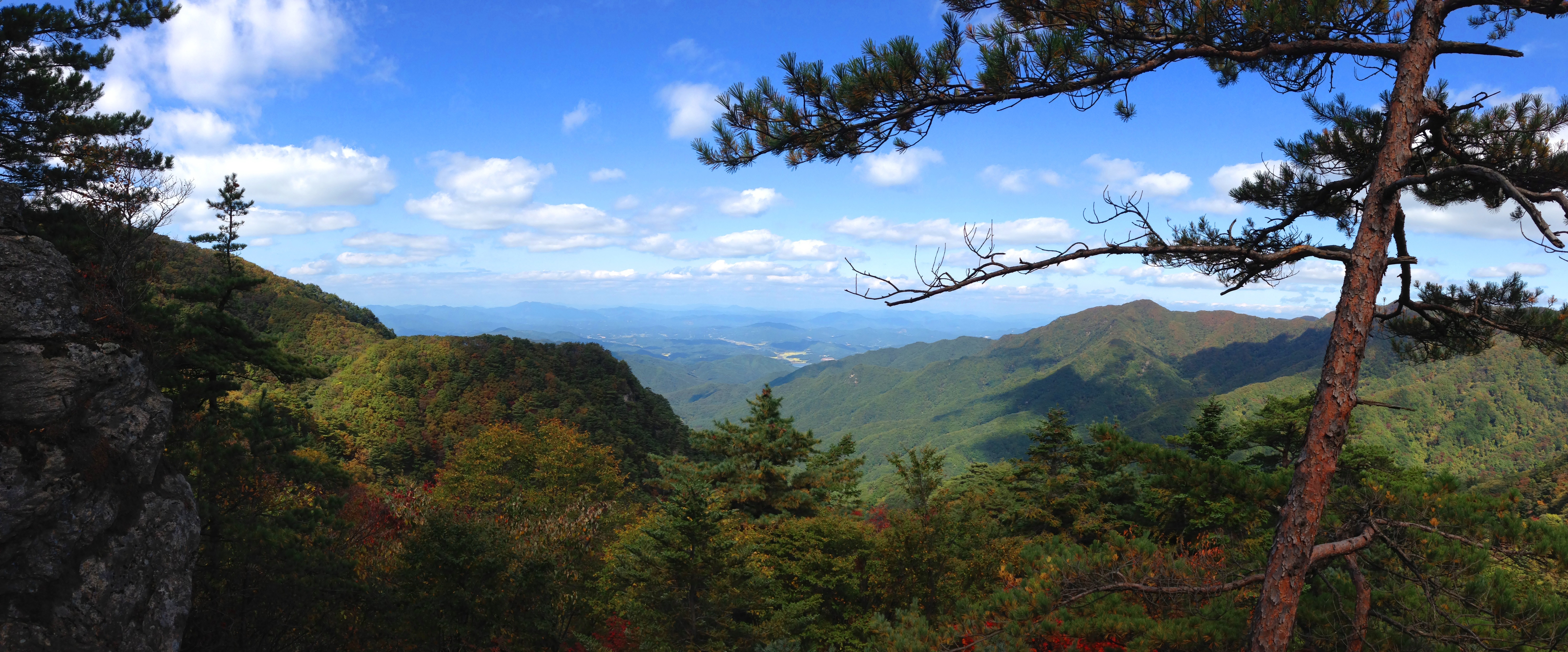
And oh, in case you didn’t notice, the autumn colors continued to be present here in Chiaksan! Down at the bottom most everything was still green, but now that we were around 1000m, the colors were brilliant.

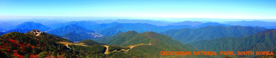
The majority of the trail was in the woods, so we knew we were making a lot of progress in terms of elevation gained, but we couldn’t see out to gauge how high up we were. Just a few hundred meters before the summit, we came to a little clearing where we could look out, and smiles came to our faces. What a gorgeous day! Sights like this provide us with an energy-boost and motivation to get to the tippy-top.
We made it to the 1288m Birobong Peak in a little over an hour after leaving Seryeom Waterfall. It was painful, but we made pretty darn good time.

With little food consumed since early morning, we were ready for some snacks on top of this beautiful mountain. The summit area was pretty spacious, and good thing, because there was a fair amount of people also enjoying the peak!

Again, what a lovely day to be out hiking – visibility was pretty good!

I snapped this picture of Korean hikers atop, looking out in both accomplishment and awe at the surroundings. Their faces say it all.

A little bit of a close-up to show the changing leaves at the higher elevations:

We could literally see for miles and miles…

We spent a good amount of time atop Birobong Peak. At 1288m it certainly doesn’t crack the Top 25 Highest Peaks in South Korea but it was definitely high enough to create a superb vantage point, that’s for sure.

After we soaked in the surroundings for a while, it hit me how this was the second-to-last national park we’d visit in Korea! Our goal of seeing all 16 mountainous parks is almost finished, Chiaksan being #15. This realization wasn’t a surprise to me in any way, but for some reason, sitting atop the mountain this day, I recalled all the trails we’ve seen, peaks we’ve summited, and places we’ve camped. This adventure to complete the goal has been downright awesome, each experience seeing all the parks uniquely beautiful. And thinking of all these things was like a tidal wave of endorphins. Man, what a cool and beautiful country we live in, and visiting all the parks is the perfect way to see darn-near the entire country.

We went down the adjacent trail we went up. There were a lot less stairs on this one, and it was mostly rocks. It made going down a bit slower because of the unsure footing, whereas if you’d hike our route in reverse, you would experience rocks going up and stairs going down (probably quicker and more safe). We took our time and enjoyed our stroll downward, chatting the whole way. The above picture is of a nice little bridge we crossed on the way down.
We arrived at Seryeom Waterfall, then finished the easy trail back down to Daegok Campground where our car was parked. It was maybe 4:00pm, so we set up our tent, cooked hot dogs like the Americans we are, and laid in the hammock until long after the sun went down behind the valley. The autumn nights are chilly in Korea, so eventually we got chased into our tent to find warmth in our 20F sleeping bags. Success!
What a great day in Chiaksan National Park.
15 down, one to go!
Bukhansan National Park in Seoul will be the final one.